The Spanish company Integrasys believes that episodes like the one this summer in Ceuta demonstrate the value of analyzing satellite observation imagery and turning it into operational intelligence to anticipate high-pressure situations and support the decisions of the Security Forces and Law Enforcement agencies.
The issue is timely in light of calls circulating on social media to attempt new irregular entries, prompting Spanish authorities to strengthen border security and monitor open-source intelligence to assess alerts.
For Integrasys, in these situations it is not enough to have images of a region; the key is to analyze them quickly, compare them with prior information, and detect on-the-ground changes, movements, and concentrations of people or vehicles. This capability turns observation into intelligence and shortens the time between detecting a change and responding.
From Image to Intelligence
Spain already has its own capabilities in intelligence, surveillance, reconnaissance, and geospatial analysis. The challenge is to better leverage the growing volume of information available and automate part of its analysis to detect relevant changes earlier.
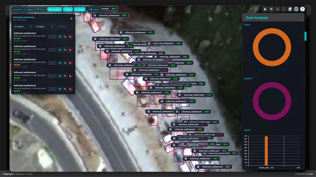
In this context Integrasys has developed in Spain EO Master, a technology that uses artificial intelligence and machine learning to analyze optical and radar satellite imagery, compare images taken at different times, and detect changes, objects, and patterns. Its value lies in turning that information into actionable knowledge for decision-makers who must act quickly and with confidence.
This type of capability does not replace the existing means of intelligence, surveillance, or security, but complements them. It can be used for border monitoring and other sensitive areas, but also in emergencies and natural disasters, in protecting critical infrastructure, or in defense scenarios.
France has a specific geospatial intelligence capability that combines information from various sources and sensors to evaluate how a situation is evolving and to support decision-making. Italy likewise has military capabilities to acquire, process, and exploit satellite imagery using systems such as COSMO-SkyMed and OPTSAT-3000.
For Álvaro Sánchez, CEO of Integrasys, “today the challenge is not merely having images, but being able to turn them into timely intelligence. In situations that evolve within a few hours, identifying changes and trends helps evaluate scenarios, prioritize resources, and act with greater knowledge. Spain has highly relevant capabilities and also its own technology to continue advancing in this field.”